Advanced configuration
Application settings
Spatial extents
In order to check your configuration of spatial extents, a small tool is available at http://server/tools/extents/.
Note
Administrator privileges are required.
Email settings
Geotrek-admin will send emails:
to administrators when internal errors occur
to managers when a feedback report is created
Email configuration takes place in /opt/geotrek-admin/var/conf/custom.py, where you control
recipients emails (ADMINS, MANAGERS) and email server configuration.
Set configuration settings in geotrek/settings/custom.py.dist template file.
You can test your configuration with the following command. A fake email will be sent to the managers:
sudo geotrek sendtestemail --managers
API
API_IS_PUBLIC = True
Choose if you want the API V2 to be available for everyone without authentication. This API provides access to promotion content (Treks, POIs, Touristic Contents …). Set to False if Geotrek is intended to be used only for managing content and not promoting them. Note that this setting does not impact the Path endpoints, which means that the Paths informations will always need authentication to be display in the API, regardless of this setting.
Swagger API documentation
In order to enable swagger module to auto-document API /api/v2/, in the custom settings file,
add the following code:
# Enable API v2 documentation
INSTALLED_APPS += ('drf_yasg', )
Then run sudo dpkg-reconfigure -u geotrek-admin.
Control number of workers and request timeouts
By default, the application runs on 4 processes, and timeouts after 30 seconds.
To control those values, edit and fix your docker-compose.yml file in web and api section.
To know how many workers you should set, please refer to gunicorn documentation.
External authent
You can authenticate user against a remote database table or view.
To enable this feature, fill these fields in /opt/geotrek-admin/var/conf/custom.py:
AUTHENT_DATABASE = 'authent'
DATABASES['authent'] = {
    'ENGINE': 'django.contrib.gis.db.backends.postgis',
    'NAME': '<database name>',
    'USER': '<user name>',
    'PASSWORD': '<password>',
    'HOST': '<host>',
    'PORT': '<port>',
}
AUTHENT_TABLENAME = '<table name>'
AUTHENTICATION_BACKENDS = ['geotrek.authent.backend.DatabaseBackend']
Expected columns in table/view are :
username : string (unique)
first_name : string
last_name : string
password : string (simple md5 encoded, or full hashed and salted password)
email : string
level : integer (1: readonly, 2: redactor, 3: path manager, 4: trekking manager, 5: management and trekking editor, 6: administrator)
structure : string
lang : string (language code)
Note
The schema used in AUTHENT_TABLENAME must be in the user search_path (ALTER USER $geotrek_db_user SET search_path=public,userschema;)
User management will be disabled from Administration backoffice.
In order to disable remote login, just comment AUTHENTICATION_BACKENDS line in settings file, and restart instance (see paragraph above).
Geotrek-admin can support many types of users authentication (LDAP, oauth, …), contact us for more details.
Custom SQL
Put your custom SQL in a file name /opt/geotrek-admin/var/conf/extra_sql/<app name>/<pre or post>_<script name>.sql
app name is the name of the Django application, eg. trekking or tourism
pre_… scripts are executed before Django migrations andpost_… scripts afterscript are executed in INSTALLED_APPS order, then by alphabetical order of script names
Map settings
Change or add WMTS tiles layers (IGN, OSM, Mapbox…)
By default, you have 2 basemaps layers in your Geotrek-admin (OSM and OSM black and white):
LEAFLET_CONFIG['TILES'] = [
('Scan', '//wxs.ign.fr/<key>/wmts?LAYER=GEOGRAPHICALGRIDSYSTEMS.MAPS.SCAN-EXPRESS.STANDARD&EXCEPTIONS=image/jpeg&FORMAT=image/jpeg&SERVICE=WMTS&VERSION=1.0.0&REQUEST=GetTile&STYLE=normal&TILEMATRIXSET=PM&TILEMATRIX={z}&TILEROW={y}&TILECOL={x}',
'© IGN - GeoPortail'),
('Ortho', '//wxs.ign.fr/<key>/wmts?LAYER=ORTHOIMAGERY.ORTHOPHOTOS&EXCEPTIONS=image/jpeg&FORMAT=image/jpeg&SERVICE=WMTS&VERSION=1.0.0&REQUEST=GetTile&STYLE=normal&TILEMATRIXSET=PM&TILEMATRIX={z}&TILEROW={y}&TILECOL={x}',
'© IGN - GeoPortail'),
('Cadastre', '//wxs.ign.fr/<key>/wmts?LAYER=CADASTRALPARCELS.PARCELS&EXCEPTIONS=image/jpeg&FORMAT=image/png&SERVICE=WMTS&VERSION=1.0.0&REQUEST=GetTile&STYLE=normal&TILEMATRIXSET=PM&TILEMATRIX={z}&TILEROW={y}&TILECOL={x}',
'© IGN - GeoPortail'),
('OSM', 'http://{s}.tile.osm.org/{z}/{x}/{y}.png', '© OSM contributors'),
]
LEAFLET_CONFIG['OVERLAYS'] = [
('Cadastre',
'//wxs.ign.fr/<key>/wmts?LAYER=CADASTRALPARCELS.PARCELS&EXCEPTIONS=text/xml&FORMAT=image/png&SERVICE=WMTS&VERSION=1.0.0&REQUEST=GetTile&STYLE=bdparcellaire_o&TILEMATRIXSET=PM&TILEMATRIX={z}&TILEROW={y}&TILECOL={x}',
'© IGN - GeoPortail'),
]
You can change or add more basemaps layers like this:
LEAFLET_CONFIG['TILES'] = [('NAME_OF_TILE', 'URL', 'COPYRIGHT'), ...]
Specify the tiles URLs this way in your custom Django setting file:
LEAFLET_CONFIG['TILES'] = [
    ('OSM', 'http://{s}.tile.openstreetmap.org/{z}/{x}/{y}.png', '© OpenStreetMap Contributors'),
    ('OpenTopoMap', 'http://a.tile.opentopomap.org/{z}/{x}/{y}.png', 'Map data: © OpenStreetMap contributors, SRTM | Map style: © OpenTopoMap (CC-BY-SA)'),
]
Example with IGN and OSM basemaps:
LEAFLET_CONFIG['TILES'] = [
    ('IGN Scan', '//wxs.ign.fr/YOURAPIKEY/wmts?LAYER=GEOGRAPHICALGRIDSYSTEMS.MAPS&EXCEPTIONS=image/jpeg&FORMAT=image/jpeg&SERVICE=WMTS&VERSION=1.0.0&REQUEST=GetTile&STYLE=normal&TILEMATRIXSET=PM&TILEMATRIX={z}&TILEROW={y}&TILECOL={x}', '© IGN Geoportail'),
    ('IGN Plan V2', '//wxs.ign.fr/essentiels/geoportail/wmts?LAYER=GEOGRAPHICALGRIDSYSTEMS.PLANIGNV2&EXCEPTIONS=image/png&FORMAT=image/png&SERVICE=WMTS&VERSION=1.0.0&REQUEST=GetTile&STYLE=normal&TILEMATRIXSET=PM&TILEMATRIX={z}&TILEROW={y}&TILECOL={x}', '© IGN Geoportail'),
    ('IGN Ortho', '//wxs.ign.fr/essentiels/geoportail/wmts?LAYER=ORTHOIMAGERY.ORTHOPHOTOS&EXCEPTIONS=image/jpeg&FORMAT=image/jpeg&SERVICE=WMTS&VERSION=1.0.0&REQUEST=GetTile&STYLE=normal&TILEMATRIXSET=PM&TILEMATRIX={z}&TILEROW={y}&TILECOL={x}', '© IGN Geoportail'),
    ('IGN Cadastre', '//wxs.ign.fr/essentiels/geoportail/wmts?LAYER=CADASTRALPARCELS.PARCELLAIRE_EXPRESS&EXCEPTIONS=image/jpeg&FORMAT=image/png&SERVICE=WMTS&VERSION=1.0.0&REQUEST=GetTile&STYLE=bdparcellaire_o&TILEMATRIXSET=PM&TILEMATRIX={z}&TILEROW={y}&TILECOL={x}', '© IGN Geoportail'),
    ('OSM', 'https//{s}.tile.openstreetmap.org/{z}/{x}/{y}.png', '© OpenStreetMap contributors'),
    ('OSM Stamen Terrain', '//tile.stamen.com/terrain/{z}/{x}/{y}.jpg', '© OpenStreetMap contributors / Stamen Design'),
    ('OpenTopoMap', 'https//a.tile.opentopomap.org/{z}/{x}/{y}.png', 'Map data: © OpenStreetMap contributors, SRTM | Map style: © OpenTopoMap (CC-BY-SA)')
]
To use some IGN Geoportail WMTS tiles (Scan25, Scan100, etc.), you may need an API key. You can find more information about this on https://geoservices.ign.fr/services-web-issus-des-scans-ign.
Map layers zoom
You can define the max_zoom the user can zoom for all tiles.
LEAFLET_CONFIG['MAX_ZOOM'] = 19
It can be interesting when your tiles can’t go to a zoom. For example OpenTopoMap is 17.
Map layers colors and style
All layers colors can be customized from the settings. See Leaflet reference for vectorial layer style.
MAPENTITY_CONFIG['MAP_STYLES']['path'] = {'color': 'red', 'weight': 5}
Or change just one parameter (the opacity for example):
MAPENTITY_CONFIG['MAP_STYLES']['city']['opacity'] = 0.8
Regarding colors that depend from database content, such as land layers (physical types, work management…) or restricted areas. We use a specific setting that receives a list of colors:
COLORS_POOL['restrictedarea'] = ['#ff00ff', 'red', '#ddddd'...]
See the default values in geotrek/settings/base.py for the complete list
of available styles.
MAPENTITY_CONFIG['MAP_STYLES'] = {
    'path': {'weight': 2, 'opacity': 1.0, 'color': '#FF4800'},
    'draftpath': {'weight': 5, 'opacity': 1, 'color': 'yellow', 'dashArray': '8, 8'},
    'city': {'weight': 4, 'color': 'orange', 'opacity': 0.3, 'fillOpacity': 0.0},
    'district': {'weight': 6, 'color': 'orange', 'opacity': 0.3, 'fillOpacity': 0.0, 'dashArray': '12, 12'},
    'restrictedarea': {'weight': 2, 'color': 'red', 'opacity': 0.5, 'fillOpacity': 0.5},
    'land': {'weight': 4, 'color': 'red', 'opacity': 1.0},
    'physical': {'weight': 6, 'color': 'red', 'opacity': 1.0},
    'competence': {'weight': 4, 'color': 'red', 'opacity': 1.0},
    'workmanagement': {'weight': 4, 'color': 'red', 'opacity': 1.0},
    'signagemanagement': {'weight': 5, 'color': 'red', 'opacity': 1.0},
    'print': {'path': {'weight': 1},
              'trek': {'color': '#FF3300', 'weight': 7, 'opacity': 0.5,
                       'arrowColor': 'black', 'arrowSize': 10},}
}
Color of the different layers on the map
COLORS_POOL = {'land': ['#f37e79', '#7998f3', '#bbf379', '#f379df', '#f3bf79', '#9c79f3', '#7af379'],
               'physical': ['#f3799d', '#79c1f3', '#e4f379', '#de79f3', '#79f3ba', '#f39779', '#797ff3'],
               'competence': ['#a2f379', '#f379c6', '#79e9f3', '#f3d979', '#b579f3', '#79f392', '#f37984'],
               'signagemanagement': ['#79a8f3', '#cbf379', '#f379ee', '#79f3e3', '#79f3d3'],
               'workmanagement': ['#79a8f3', '#cbf379', '#f379ee', '#79f3e3', '#79f3d3'],
               'restrictedarea': ['plum', 'violet', 'deeppink', 'orchid',
                                  'darkviolet', 'lightcoral', 'palevioletred',
                                  'MediumVioletRed', 'MediumOrchid', 'Magenta',
                                  'LightSalmon', 'HotPink', 'Fuchsia']}
Color of the different layers on the top right for landing.
For land, physical, competence, signagemanagement, workmanagement should have 5 values.
For restricted Area: add as many color as your number of restricted area type
Restart the application for changes to take effect.
External raster layers
It is possible to add overlay tiles layer on maps. For example, it can be useful to:
Get the cadastral parcels on top of satellite images
Home made layers (with Tilemill or QGisMapserver for example). Like the park center borders, traffic maps, IGN BDTopo® or even the Geotrek paths that are marked as invisible in the database!
In custom.py, just add the following lines:
LEAFLET_CONFIG['OVERLAYS'] = [
    ('Cadastre', '//wxs.ign.fr/essentiels/geoportail/wmts?LAYER=CADASTRALPARCELS.PARCELLAIRE_EXPRESS&EXCEPTIONS=image/jpeg&FORMAT=image/png&SERVICE=WMTS&VERSION=1.0.0&REQUEST=GetTile&STYLE=normal&TILEMATRIXSET=PM&TILEMATRIX={z}&TILEROW={y}&TILECOL={x}', '© IGN - GeoPortail')
    ('Coeur de parc', 'http://serveur/coeur-parc/{z}/{x}/{y}.png', '© PNF'),
]
Expected properties:
For GeoJSON files, you can provide the following properties :
title: stringdescription: stringwebsite: stringphone: stringpictures: list of objects withurlandcopyrightattributescategory: object withidandlabelattributes
Geographical CRUD
PATH_SNAPPING_DISTANCE = 2.0
Minimum distance to merge 2 paths in unit of SRID
Change the distance. Better to keep it like this. Not used when ``TREKKING_TOPOLOGY_ENABLED = True``.
SNAP_DISTANCE = 30
Distance of snapping for the cursor in pixels on Leaflet map.
PATH_MERGE_SNAPPING_DISTANCE = 2
Minimum distance to merge 2 paths.
Change the distance. Should be higher or the same as PATH_SNAPPING_DISTANCE
Used when TREKKING_TOPOLOGY_ENABLED = True
TREK_POINTS_OF_REFERENCE_ENABLED = True
Points of reference are enabled on form of treks.
OUTDOOR_COURSE_POINTS_OF_REFERENCE_ENABLED = True
Points of reference are enabled on form of otudoor courses.
TOPOLOGY_STATIC_OFFSETS = {'land': -5, 'physical': 0, 'competence': 5, 'signagemanagement': -10, 'workmanagement': 10}
Land objects are added on other objects (path for example) with offset, avoiding overlay.
You should not change it to avoid overlay except if you want to have more overlay. You can do for example for :
TOPOLOGY_STATIC_OFFSETS = {'land': -7, 'physical': 0, 'competence': 7, 'signagemanagement': -14, 'workmanagement': 14}
ALTIMETRIC_PROFILE_PRECISION = 25  # Sampling precision in meters
ALTIMETRIC_PROFILE_AVERAGE = 2  # nb of points for altimetry moving average
ALTIMETRIC_PROFILE_STEP = 1  # Step min precision for positive / negative altimetry gain
ALTIMETRIC_PROFILE_BACKGROUND = 'white'
ALTIMETRIC_PROFILE_COLOR = '#F77E00'
ALTIMETRIC_PROFILE_HEIGHT = 400
ALTIMETRIC_PROFILE_WIDTH = 800
ALTIMETRIC_PROFILE_FONTSIZE = 25
ALTIMETRIC_PROFILE_FONT = 'ubuntu'
ALTIMETRIC_PROFILE_MIN_YSCALE = 1200  # Minimum y scale (in meters)
ALTIMETRIC_AREA_MAX_RESOLUTION = 150  # Maximum number of points (by width/height)
ALTIMETRIC_AREA_MARGIN = 0.15
All settings used to generate altimetric profile.
All these settings can be modified but you need to check the result every time
The only one modified most of the time is ALTIMETRIC_PROFILE_COLOR
Disable darker map backgrounds
Since IGN map backgrounds are very dense and colourful, a dark opacity is applied. In order to disable, change this MapEntity setting:
MAPENTITY_CONFIG['MAP_BACKGROUND_FOGGED'] = False
Map screenshots
SHOW_SENSITIVE_AREAS_ON_MAP_SCREENSHOT = True
SHOW_POIS_ON_MAP_SCREENSHOT = True
SHOW_SERVICES_ON_MAP_SCREENSHOT = True
SHOW_SIGNAGES_ON_MAP_SCREENSHOT = True
SHOW_INFRASTRUCTURES_ON_MAP_SCREENSHOT = True
Show objects on maps of PDF
MAP_CAPTURE_SIZE = 800
Size in pixels of the capture.
Be careful with your pdfs. If you change this value, pdfs will be rendered differently
Modules and components
Enable Apps
In order to disable a full set of modules, in the custom settings file, add the following code:
# Disable infrastructure and maintenance
_INSTALLED_APPS = list(INSTALLED_APPS)
_INSTALLED_APPS.remove('geotrek.infrastructure')
_INSTALLED_APPS.remove('geotrek.maintenance')
INSTALLED_APPS = _INSTALLED_APPS
In order to remove notion of trails:
TRAIL_MODEL_ENABLED = False
In order to remove landedge model:
LANDEDGE_MODEL_ENABLED = False
In order to remove zoning combo-boxes on list map:
LAND_BBOX_CITIES_ENABLED = False
LAND_BBOX_DISTRICTS_ENABLED = False
LAND_BBOX_AREAS_ENABLED = False
In order to hide TouristicContents and TouristicEvents on menu:
TOURISM_ENABLED = False
In order to hide Flatpages on menu. Flatpages are used in Geotrek-rando.
FLATPAGES_ENABLED = False
In order to hide the accessibility menu for attachments:
ACCESSIBILITY_ATTACHMENTS_ENABLED = False
Note
By doing so, some software upgrades may not be as smooth as usual. Never forget to mention this customization if you ask for community support.
Paths
ALLOW_PATH_DELETION_TOPOLOGY = True
If false, it forbid to delete a path when at least one topology is linked to this path.
ALERT_DRAFT = False
If True, it sends a message to managers (MANAGERS) whenever a path has been changed to draft.
Email configuration takes place in /opt/geotrek-admin/var/conf/custom.py, where you control
recipients emails (ADMINS, MANAGERS) and email server configuration.
ALERT_REVIEW = False
If True, it sends a message to managers (MANAGERS) whenever an object which can be published has been changed to review mode.
Email configuration takes place in /opt/geotrek-admin/var/conf/custom.py, where you control
recipients emails (ADMINS, MANAGERS) and email server configuration.
Signage and Blade
BLADE_ENABLED and LINE_ENABLED settings (default to True) allow to enable or disable blades and lines submodules.
DIRECTION_ON_LINES_ENABLED setting (default to False) allow to have the direction field on lines instead of blades.
BLADE_CODE_TYPE = int
Type of the blade code (str or int)
It can be str or int.
If you have an integer code : int
If you have an string code : str
BLADE_CODE_FORMAT = "{signagecode}-{bladenumber}"
Correspond to the format of blades. Show N3-1 for the blade 1 of the signage N3.
If you want to change : move information under bracket
You can also remove one element between bracket
You can do for exemple : “CD99.{signagecode}.{bladenumber}”
It will display : CD99.XIDNZEIU.01 (first blade of XIDNZEIU)
signagecode is the code of the signage
bladenumber is the number of the blade
LINE_CODE_FORMAT = "{signagecode}-{bladenumber}-{linenumber}"
Correspond to the format used in export of lines. Used in csv of signage.
Similar with above You can do for example : “CD99.{signagecode}-{bladenumber}.{linenumber}”
It will display : CD99.XIDNZEIU-01.02 (second line of the first blade of XIDNZEIU)
signagecode is the code of the signage
bladenumber is the number of the blade
linenumber is the number of the line
Diving
In order to enable diving module, in the custom settings file, add the following code:
# Enable diving module
INSTALLED_APPS += ('geotrek.diving', )
Then run sudo dpkg-reconfigure -pcritical geotrek-admin.
You can also insert diving minimal data (default practices, difficulties, levels and group permissions values):
sudo geotrek loaddata /opt/geotrek-admin/lib/python*/site-packages/geotrek/diving/fixtures/basic.json
cp /opt/geotrek-admin/lib/python*/site-packages/geotrek/diving/fixtures/upload/* /opt/geotrek-admin/var/media/upload/
You can insert licenses of attachments with this command :
sudo geotrek loaddata /opt/geotrek-admin/lib/python*/site-packages/geotrek/common/fixtures/licenses.json
Outdoor
In order to enable Outdoor module, in the custom settings file, add the following code:
# Enable Outdoor module
INSTALLED_APPS += ('geotrek.outdoor', )
Then run sudo dpkg-reconfigure -pcritical geotrek-admin.
You can also insert Outdoor minimal data:
sudo geotrek loaddata /opt/geotrek-admin/lib/python*/site-packages/geotrek/outdoor/fixtures/basic.json
After installing Outdoor module, you have to add permissions to your user groups on outdoor sites and courses.
Note: Outdoor module is not compatible with PostGIS <= 2.4 that is included in Ubuntu 18.04. You should either upgrade to Ubuntu 20.04 or upgrade postGIS to 2.5 with https://launchpad.net/~ubuntugis/+archive/ubuntu/ppa
Sensitive areas
In order to enable sensitivity module, in the custom settings file, add the following code:
# Enable sensitivity module
INSTALLED_APPS += ('geotrek.sensitivity', )
See sensitivity section for settings and imports.
Feedback reports settings
Send acknowledge email
SEND_REPORT_ACK = True
If false, no email will be sent to the sender of any feedback on Geotrek-rando website
Suricate support
Geotrek reports can work together with Suricate API, using one of 3 modes. Proceed through a mode full configuration before proceeding to the next mode.
1 - No Suricate (default)
This mode sends no report data to Suricate.
To initialize Report forms (Geotrek-admin, Geotrek-rando-v2, Geotrek-rando-v3) load lists for categories, activities, statuses and problem magnitude:
geotrek loaddata /opt/geotrek-admin/lib/python*/site-packages/geotrek/feedback/fixtures/basic.json
To make these lists available for your Geotrek-rando-v2, run sync_rando (see synchronization)
2 - Suricate Standard
This mode simply forwards all reports to Suricate, using the Standard API to post reports.
Set your account settings in custom.py:
SURICATE_REPORT_ENABLED = True

SURICATE_REPORT_SETTINGS = {
    'URL': '<Suricate Standard API Url>',
    'ID_ORIGIN': '<Suricate origin ID>',
    'PRIVATE_KEY_CLIENT_SERVER': '<your private key client / server>',
    'PRIVATE_KEY_SERVER_CLIENT': '<your private key server / client>',
}
3 - Suricate Management (Workflow)
This mode allows to retrieve reports and related data directly from Suricate, using the Management API to get data. It is used to process and manage reports, using the Intervention module and following a predefined worklow, while sending all progress to Suricate. It implies enabling Suricate Report mode as well. You can find a detailled explanation on the workflow here : https://github.com/GeotrekCE/Geotrek-admin/issues/2366#issuecomment-1113435035
Set your settings in
custom.py:
SURICATE_WORKFLOW_ENABLED = True

SURICATE_MANAGEMENT_SETTINGS = {
    'URL': '<Suricate Management API Url>',
    'ID_ORIGIN': '<Suricate origin ID>',
    'PRIVATE_KEY_CLIENT_SERVER': '<your private key client / server>',
    'PRIVATE_KEY_SERVER_CLIENT': '<your private key server / client>',
}

SURICATE_WORKFLOW_SETTINGS = {
    "SURICATE_RELOCATED_REPORT_MESSAGE": "This report is not located in Workflow responsiblity area.",
    "SKIP_MANAGER_MODERATION": False
}
You can use the following command to test your connection settings:
geotrek sync_suricate -v 2 --connection-test
Load lists for activities and/or report statuses from Suricate:
geotrek sync_suricate --activities --statuses -v 2
Load alerts from Suricate (located in your bounding box) :
geotrek sync_suricate -v 2 --no-notification
To make these lists available for your Geotrek-rando, run sync_rando (see synchronization)
Then load extra required statuses for Reports and Interventions:
geotrek loaddata /opt/geotrek-admin/lib/python*/site-packages/geotrek/feedback/fixtures/management_workflow.json
geotrek loaddata /opt/geotrek-admin/lib/python*/site-packages/geotrek/maintenance/fixtures/basic.json
- Go to the Admin Site and
if you want to include the moderation steps (SKIP_MANAGER_MODERATION = False), select a user as Workflow Manager (/admin/feedback/workflowmanager/). Their role is to assign reports to other users.
select a district as Workflow District (/admin/feedback/workflowdistrict/). This zone defines the area of reponsibility for reports. Reports relocated outside of the district will be excluded from workflow.
create predefined emails (/admin/feedback/predefinedemail/) to notify Suricate Sentinels and Administrators. You can use ##intervention_date## and ##supervisor## in the messages’ body to automatically replace with the report’s linked Intervention date and author. The Extended Username field will be dsiplayed (see User Profile under /admin/auth/user/).
make sure Users involved in the workflow have proper permissions to create and update Reports and Interventions (/admin/auth/user/)
Be aware that, when enabling Suricate Management mode, Suricate becomes the master database for reports. This means reports created in Geotrek-admin will not be saved to the database, they will only be sent to Suricate. Reports are only saved when synchronized back from Suricate, when the synchronization command is run. Make sure to run these 3 commands daily to maintain synchronization and update reports (thanks to cron for instance) :
geotrek retry_failed_requests_and_mails
geotrek check_timers
geotrek sync_suricate
Display reports with status defined colors
ENABLE_REPORT_COLORS_PER_STATUS = True
Go to the Admin Site and select colors to display for each status (/admin/feedback/reportstatus/).
Use timers to receive alerts for your reports
It is possible to enable receiving email alerts for reports that have remained in the same status for too long. For instance, I can create two report statuses “To program” with timer days set to 10 and “Programmed” with timer days set to 0. If a report has had status “To program” for 10 days, an email alert will be sent. If its status is changed to “Programmed” within these 10 days, this will cancel the alert. The email alert will be sent to the assigned user for this report, or to managers (setting MANAGERS) if there is no assigned user.
To enable the alerts :
Go to the Admin Site and set “Timer days” to some integer other than 0 in relevant statuses (/admin/feedback/reportstatus/)
Select the “Uses timers” checkbox on reports that you wish to receive alerts for (in report update form)
Make sure to run this commands daily to send email alerts and clear obsolete timers (thanks to cron for instance) :
geotrek check_timers
Anonymize feedback reports
To be compliant to GDPR, you cannot keep personnal data infinitely, and should notice your users on how many time you keep their email.
A Django command is available to anonymize reports, by default older than 365 days.
geotrek erase_emails
Or if you want to erase emails for reports older than 90 days
geotrek erase_emails --days 90
Attachments
View attachments in the browser
Attached files are downloaded by default by browser, with the following line, files will be opened in the browser :
MAPENTITY_CONFIG['SERVE_MEDIA_AS_ATTACHMENT'] = False
Resizing uploaded pictures
Attached pictures can be resized at upload by enabling PAPERCLIP_RESIZE_ATTACHMENTS_ON_UPLOAD:
PAPERCLIP_RESIZE_ATTACHMENTS_ON_UPLOAD = True
These corresponding height/width parameters can be overriden to select resized image size:
PAPERCLIP_MAX_ATTACHMENT_WIDTH = 1280
PAPERCLIP_MAX_ATTACHMENT_HEIGHT = 1280
Prohibit usage of big pictures and small width / height
If you want to prohibit the usage of heavy pictures:
PAPERCLIP_MAX_BYTES_SIZE_IMAGE = 50000 # Bytes
If you want to prohibit the usage of small pictures in pixels:
PAPERCLIP_MIN_IMAGE_UPLOAD_WIDTH = 100
PAPERCLIP_MIN_IMAGE_UPLOAD_HEIGHT = 100
These 3 settings will also not allow downloading images from the parsers.
Prohibit usage of certain file types
Paperclip will only accept attachment files matching a list of allowed extensions. Here is the default value for this setting, which you can extend if needed:
PAPERCLIP_ALLOWED_EXTENSIONS = [
    'jpeg',
    'jpg',
    'mp3',
    'mp4',
    'odt',
    'pdf',
    'png',
    'svg',
    'txt',
    'gif',
    'tiff',
    'tif',
    'docx',
    'webp',
    'bmp',
    'flac',
    'mpeg',
    'doc',
    'ods',
    'gpx',
    'xls',
    'xlsx',
    'odg',
]
It will verify that the mimetype of the file matches the extension. You can add extra allowed mimetypes for a given extension with the following syntax:
PAPERCLIP_EXTRA_ALLOWED_MIMETYPES['gpx'] = ['text/xml']
You can also entirely deactivate these checks with the following:
PAPERCLIP_ALLOWED_EXTENSIONS = None
These 2 settings will also not allow downloading images from the parsers.
Interface
Configure columns displayed in lists views and exports
For each module, use the following syntax to configure columns to display in the main table.
COLUMNS_LISTS['<module>_view'] = ['list', 'of', 'columns']
For each module, use the following syntax to configure columns to export as CSV or SHP.
COLUMNS_LISTS['<module>_export'] = ['list', 'of', 'columns']
Please refer to the “settings detail” section for a complete list of modules and available columms.
Another setting exists to enable a more detailed export of jobs costs in the interventions module. When enabling this settings, interventions list exports will contain a new column for each job’s total cost.
ENABLE_JOBS_COSTS_DETAILED_EXPORT = True
Custom columns available
A (nearly?) exhaustive list of attributes available for display and export as columns in each module.
COLUMNS_LISTS["path_view"] = [
    "length_2d",
    "valid",
    "structure",
    "visible",
    "min_elevation",
    "max_elevation",
    "date_update",
    "date_insert",
    "stake",
    "networks",
    "comments",
    "departure",
    "arrival",
    "comfort",
    "source",
    "usages",
    "draft",
    "trails",
    "uuid",
]
COLUMNS_LISTS["trail_view"] = [
    "departure",
    "arrival",
    "category",
    "length",
    "structure",
    "min_elevation",
    "max_elevation",
    "date_update",
    "length_2d",
    "date_insert",
    "comments",
    "uuid",
]
COLUMNS_LISTS["landedge_view"] = [
    "eid",
    "min_elevation",
    "max_elevation",
    "date_update",
    "length_2d",
    "date_insert",
    "owner",
    "agreement",
    "uuid",
]
COLUMNS_LISTS["physicaledge_view"] = [
    "eid",
    "date_insert",
    "date_update",
    "length",
    "length_2d",
    "min_elevation",
    "max_elevation",
    "uuid",
]
COLUMNS_LISTS["competenceedge_view"] = [
    "eid",
    "date_insert",
    "date_update",
    "length",
    "length_2d",
    "min_elevation",
    "max_elevation",
    "uuid",
]
COLUMNS_LISTS["signagemanagementedge_export"] = [
    "eid",
    "date_insert",
    "date_update",
    "length",
    "length_2d",
    "min_elevation",
    "max_elevation",
    "uuid",
    "provider"
]
COLUMNS_LISTS["workmanagementedge_export"] = [
    "eid",
    "date_insert",
    "date_update",
    "length",
    "length_2d",
    "min_elevation",
    "max_elevation",
    "uuid",
]
COLUMNS_LISTS["infrastructure_view"] = [
    "condition",
    "cities",
    "structure",
    "type",
    "description",
    "accessibility",
    "date_update",
    "date_insert",
    "implantation_year",
    "usage_difficulty",
    "maintenance_difficulty",
    "published",
    "uuid",
    "eid",
    "provider",
    "access"
]
COLUMNS_LISTS["signage_view"] = [
    "code",
    "type",
    "condition",
    "structure",
    "description",
    "date_update",
    "date_insert",
    "implantation_year",
    "printed_elevation",
    "coordinates",
    "sealing",
    "access",
    "manager",
    "published",
    "uuid",
]
COLUMNS_LISTS["intervention_view"] = [
    "date",
    "type",
    "target",
    "status",
    "stake",
    "structure",
    "subcontracting",
    "status",
    "disorders",
    "length",
    "material_cost",
    "min_elevation",
    "max_elevation",
    "heliport_cost",
    "subcontract_cost",
    "date_update",
    "date_insert",
    "description",
]
COLUMNS_LISTS["project_view"] = [
    "structure",
    "begin_year",
    "end_year",
    "constraint",
    "global_cost",
    "type",
    "date_update",
    "domain",
    "contractors",
    "project_owner",
    "project_manager",
    "founders",
    "date_insert",
    "comments",
]
COLUMNS_LISTS["trek_view"] = [
    "structure",
    "departure",
    "arrival",
    "duration",
    "description_teaser",
    "description",
    "gear",
    "route",
    "difficulty",
    "ambiance",
    "access",
    "accessibility_infrastructure",
    "advised_parking",
    "parking_location",
    "public_transport",
    "themes",
    "practice",
    "min_elevation",
    "max_elevation",
    "length_2d",
    "date_update",
    "date_insert",
    "accessibilities",
    "accessibility_advice",
    "accessibility_covering",
    "accessibility_exposure",
    "accessibility_level",
    "accessibility_signage",
    "accessibility_slope",
    "accessibility_width",
    "ratings_description",
    "ratings",
    "points_reference",
    "source",
    "reservation_system",
    "reservation_id",
    "portal",
    "uuid",
    "eid",
    "eid2",
    "provider"
]
COLUMNS_LISTS["poi_view"] = [
    "structure",
    "description",
    "type",
    "min_elevation",
    "date_update",
    "date_insert",
    "uuid",
]
COLUMNS_LISTS["service_view"] = [
    "structure",
    "min_elevation",
    "type",
    "length_2d",
    "date_update",
    "date_insert",
    "uuid",
]
COLUMNS_LISTS["dive_view"] = [
    "structure",
    "description_teaser",
    "description",
    "owner",
    "practice",
    "departure",
    "disabled_sport",
    "facilities",
    "difficulty",
    "levels",
    "depth",
    "advice",
    "themes",
    "source",
    "portal",
    "date_update",
    "date_insert",
]
COLUMNS_LISTS["touristic_content_view"] = [
    "structure",
    "description_teaser",
    "description",
    "category",
    "contact",
    "email",
    "website",
    "practical_info",
    "accessibility",
    "label_accessibility",
    "type1",
    "type2",
    "source",
    "reservation_system",
    "reservation_id",
    "date_update",
    "date_insert",
    "uuid",
    "eid",
    "provider"
]
COLUMNS_LISTS["touristic_event_view"] = [
    "structure",
    "themes",
    "description_teaser",
    "description",
    "meeting_point",
    "start_time",
    "end_time",
    "duration",
    "begin_date",
    "contact",
    "email",
    "website",
    "end_date",
    "organizer",
    "speaker",
    "type",
    "accessibility",
    "capacity",
    "portal",
    "source",
    "practical_info",
    "target_audience",
    "booking",
    "date_update",
    "date_insert",
    "uuid",
    "eid",
    "provider",
    "bookable",
    "cancelled",
    "cancellation_reason"
    "place",
    'preparation_duration',
    'intervention_duration',
]
COLUMNS_LISTS["feedback_view"] = [
    "email",
    "comment",
    "activity",
    "category",
    "problem_magnitude",
    "status",
    "related_trek",
    "uuid",
    "eid",
    "external_eid",
    "locked",
    "origin"
    "date_update",
    "date_insert",
    "created_in_suricate",
    "last_updated_in_suricate",
    "assigned_user",
    "uses_timers"
]
COLUMNS_LISTS["sensitivity_view"] = [
    "structure",
    "species",
    "published",
    "publication_date",
    "contact",
    "pretty_period",
    "category",
    "pretty_practices",
    "description",
    "date_update",
    "date_insert",
]
COLUMNS_LISTS["outdoor_site_view"] = [
    "structure",
    "name",
    "practice",
    "description",
    "description_teaser",
    "ambiance",
    "advice",
    "accessibility",
    "period",
    "labels",
    "themes",
    "portal",
    "source",
    "information_desks",
    "web_links",
    "eid",
    "orientation",
    "wind",
    "ratings",
    "managers",
    "type",
    "description",
    "description_teaser",
    "ambiance",
    "period",
    "orientation",
    "wind",
    "labels",
    "themes",
    "portal",
    "source",
    "managers",
    "min_elevation",
    "date_insert",
    "date_update",
    "uuid",
]
COLUMNS_LISTS["outdoor_course_view"] = [
    "structure",
    "name",
    "parent_sites",
    "description",
    "advice",
    "equipment",
    "accessibility",
    "eid",
    "height",
    "ratings",
    "gear",
    "duration"
    "ratings_description",
    "type",
    "points_reference",
    "uuid",
]
COLUMNS_LISTS["path_export"] = [
    "structure",
    "valid",
    "visible",
    "name",
    "comments",
    "departure",
    "arrival",
    "comfort",
    "source",
    "stake",
    "usages",
    "networks",
    "date_insert",
    "date_update",
    "length_2d",
    "length",
    "ascent",
    "descent",
    "min_elevation",
    "max_elevation",
    "slope",
    "uuid",
]
COLUMNS_LISTS["trail_export"] = [
    "structure",
    "name",
    "comments",
    "departure",
    "arrival",
    "category",
    "certifications",
    "date_insert",
    "date_update",
    "cities",
    "districts",
    "areas",
    "length",
    "ascent",
    "descent",
    "min_elevation",
    "max_elevation",
    "slope",
    "uuid",
]
COLUMNS_LISTS["landedge_export"] = [
    "eid",
    "land_type",
    "owner",
    "agreement",
    "date_insert",
    "date_update",
    "cities",
    "districts",
    "areas",
    "length",
    "length_2d",
    "ascent",
    "descent",
    "min_elevation",
    "max_elevation",
    "slope",
    "uuid",
]
COLUMNS_LISTS["physicaledge_export"] = [
    "eid",
    "physical_type",
    "date_insert",
    "date_update",
    "cities",
    "districts",
    "areas",
    "length",
    "length_2d",
    "ascent",
    "descent",
    "min_elevation",
    "max_elevation",
    "slope",
    "uuid",
]
COLUMNS_LISTS["competenceedge_export"] = [
    "eid",
    "organization",
    "date_insert",
    "date_update",
    "cities",
    "districts",
    "areas",
    "length",
    "length_2d",
    "ascent",
    "descent",
    "min_elevation",
    "max_elevation",
    "slope",
    "uuid",
]
COLUMNS_LISTS["signagemanagementedge_export"] = [
    "eid",
    "organization",
    "date_insert",
    "date_update",
    "cities",
    "districts",
    "areas",
    "length",
    "length_2d",
    "ascent",
    "descent",
    "min_elevation",
    "max_elevation",
    "slope",
    "uuid",
]
COLUMNS_LISTS["workmanagementedge_export"] = [
    "eid",
    "organization",
    "date_insert",
    "date_update",
    "cities",
    "districts",
    "areas",
    "length",
    "length_2d",
    "ascent",
    "descent",
    "min_elevation",
    "max_elevation",
    "slope",
    "uuid",
]
COLUMNS_LISTS["infrastructure_export"] = [
    "name",
    "type",
    "condition",
    "access",
    "description",
    "accessibility",
    "implantation_year",
    "published",
    "publication_date",
    "structure",
    "date_insert",
    "date_update",
    "cities",
    "districts",
    "areas",
    "ascent",
    "descent",
    "min_elevation",
    "max_elevation",
    "slope",
    "usage_difficulty",
    "maintenance_difficulty"
    "uuid",
    "eid",
    "provider"
]
COLUMNS_LISTS["signage_export"] = [
    "structure",
    "name",
    "code",
    "type",
    "condition",
    "description",
    "implantation_year",
    "published",
    "date_insert",
    "date_update",
    "cities",
    "districts",
    "areas",
    "lat_value",
    "lng_value",
    "printed_elevation",
    "sealing",
    "access",
    "manager",
    "length",
    "ascent",
    "descent",
    "min_elevation",
    "max_elevation",
    "uuid",
    "eid",
    "provider"
]
COLUMNS_LISTS["intervention_export"] = [
    "name",
    "date",
    "type",
    "target",
    "status",
    "stake",
    "disorders",
    "total_manday",
    "project",
    "subcontracting",
    "width",
    "height",
    "length",
    "area",
    "structure",
    "description",
    "date_insert",
    "date_update",
    "material_cost",
    "heliport_cost",
    "subcontract_cost",
    "total_cost_mandays",
    "total_cost",
    "cities",
    "districts",
    "areas",
    "length",
    "ascent",
    "descent",
    "min_elevation",
    "max_elevation",
    "slope",
]
COLUMNS_LISTS["project_export"] = [
    "structure",
    "name",
    "period",
    "type",
    "domain",
    "constraint",
    "global_cost",
    "interventions",
    "interventions_total_cost",
    "comments",
    "contractors",
    "project_owner",
    "project_manager",
    "founders",
    "date_insert",
    "date_update",
    "cities",
    "districts",
    "areas",
]
COLUMNS_LISTS["trek_export"] = [
    "eid",
    "eid2",
    "structure",
    "name",
    "departure",
    "arrival",
    "duration",
    "duration_pretty",
    "description",
    "description_teaser",
    "gear",
    "networks",
    "advice",
    "ambiance",
    "difficulty",
    "information_desks",
    "themes",
    "practice",
    "accessibilities",
    "accessibility_advice",
    "accessibility_covering",
    "accessibility_exposure",
    "accessibility_level",
    "accessibility_signage",
    "accessibility_slope",
    "accessibility_width",
    "ratings_description",
    "ratings",
    "access",
    "route",
    "public_transport",
    "advised_parking",
    "web_links",
    "labels",
    "accessibility_infrastructure",
    "parking_location",
    "points_reference",
    "related",
    "children",
    "parents",
    "pois",
    "review",
    "published",
    "publication_date",
    "date_insert",
    "date_update",
    "cities",
    "districts",
    "areas",
    "source",
    "portal",
    "length_2d",
    "length",
    "ascent",
    "descent",
    "min_elevation",
    "max_elevation",
    "slope",
    "uuid",
    "provider"
]
COLUMNS_LISTS["poi_export"] = [
    "structure",
    "eid",
    "name",
    "type",
    "description",
    "treks",
    "review",
    "published",
    "publication_date",
    "structure",
    "date_insert",
    "date_update",
    "cities",
    "districts",
    "areas",
    "length",
    "ascent",
    "descent",
    "min_elevation",
    "max_elevation",
    "slope",
    "uuid",
]
COLUMNS_LISTS["service_export"] = [
    "eid",
    "type",
    "length",
    "ascent",
    "descent",
    "min_elevation",
    "max_elevation",
    "slope",
    "uuid",
]
COLUMNS_LISTS["dive_export"] = [
    "eid",
    "structure",
    "name",
    "departure",
    "description",
    "description_teaser",
    "advice",
    "difficulty",
    "levels",
    "themes",
    "practice",
    "disabled_sport",
    "published",
    "publication_date",
    "date_insert",
    "date_update",
    "areas",
    "source",
    "portal",
    "review",
    "uuid",
]
COLUMNS_LISTS["touristic_content_export"] = [
    "structure",
    "eid",
    "name",
    "category",
    "type1",
    "type2",
    "description_teaser",
    "description",
    "themes",
    "contact",
    "email",
    "website",
    "practical_info",
    "accessibility",
    "label_accessibility",
    "review",
    "published",
    "publication_date",
    "source",
    "portal",
    "date_insert",
    "date_update",
    "cities",
    "districts",
    "areas",
    "approved",
    "uuid",
    "provider"
]
COLUMNS_LISTS["touristic_event_export"] = [
    "structure",
    "eid",
    "name",
    "type",
    "description_teaser",
    "description",
    "themes",
    "begin_date",
    "end_date",
    "duration",
    "meeting_point",
    "start_time",
    "end_time",
    "contact",
    "email",
    "website",
    "organizer",
    "speaker",
    "accessibility",
    "capacity",
    "booking",
    "target_audience",
    "practical_info",
    "date_insert",
    "date_update",
    "source",
    "portal",
    "review",
    "published",
    "publication_date",
    "cities",
    "districts",
    "areas",
    "approved",
    "uuid",
    "provider",
    "bookable",
    "cancelled",
    "cancellation_reason"
    "place",
    'preparation_duration',
    'intervention_duration'
]
COLUMNS_LISTS["feedback_export"] = [
    "comment",
    "activity",
    "category",
    "problem_magnitude",
    "status",
    "related_trek",
    "uuid",
    "eid",
    "external_eid",
    "locked",
    "origin"
    "date_update",
    "date_insert",
    "created_in_suricate",
    "last_updated_in_suricate",
    "assigned_user",
    "uses_timers"
]
COLUMNS_LISTS["sensitivity_export"] = [
    "species",
    "published",
    "description",
    "contact",
    "pretty_period",
    "pretty_practices",
]
COLUMNS_LISTS["outdoor_site_export"] = [
    "structure",
    "name",
    "practice",
    "description",
    "description_teaser",
    "ambiance",
    "advice",
    "accessibility",
    "period",
    "labels",
    "themes",
    "portal",
    "source",
    "information_desks",
    "web_links",
    "eid",
    "orientation",
    "wind",
    "ratings",
    "managers",
    "type",
    "description",
    "description_teaser",
    "ambiance",
    "period",
    "orientation",
    "wind",
    "labels",
    "themes",
    "portal",
    "source",
    "managers",
    "min_elevation",
    "date_insert",
    "date_update",
    "uuid",
]
COLUMNS_LISTS["outdoor_course_export"] = [
    "structure",
    "name",
    "parent_sites",
    "description",
    "advice",
    "equipment",
    "accessibility",
    "eid",
    "height",
    "ratings",
    "gear",
    "duration"
    "ratings_description",
    "type",
    "points_reference",
    "uuid",
]
Configure form fields in creation views
For each module, use the following syntax to configure fields to hide in the creation form.
HIDDEN_FORM_FIELDS['<module>'] = ['list', 'of', 'fields']
Please refer to the “settings detail” section for a complete list of modules and hideable fields.
Hideable form fields
An exhaustive list of form fields hideable in each module.
HIDDEN_FORM_FIELDS["path"] = [
        "departure",
        "name",
        "stake",
        "comfort",
        "arrival",
        "comments",
        "source",
        "networks",
        "usages",
        "valid",
        "draft",
        "reverse_geom",
    ],
HIDDEN_FORM_FIELDS["trek"] = [
        "structure",
        "name",
        "review",
        "published",
        "labels",
        "departure",
        "arrival",
        "duration",
        "difficulty",
        "gear",
        "route",
        "ambiance",
        "access",
        "description_teaser",
        "description",
        "points_reference",
        "accessibility_infrastructure",
        "advised_parking",
        "parking_location",
        "public_transport",
        "advice",
        "themes",
        "networks",
        "practice",
        "accessibilities",
        "accessibility_advice",
        "accessibility_covering",
        "accessibility_exposure",
        "accessibility_level",
        "accessibility_signage",
        "accessibility_slope",
        "accessibility_width",
        "web_links",
        "information_desks",
        "source",
        "portal",
        "children_trek",
        "eid",
        "eid2",
        "ratings",
        "ratings_description",
        "reservation_system",
        "reservation_id",
        "pois_excluded",
        "hidden_ordered_children",
    ],
HIDDEN_FORM_FIELDS["trail"] = [
        "departure",
        "arrival",
        "comments",
        "category",
    ],
HIDDEN_FORM_FIELDS["landedge"] = [
        "owner",
        "agreement"
    ],
HIDDEN_FORM_FIELDS["infrastructure"] = [
        "condition",
        "access",
        "description",
        "accessibility",
        "published",
        "implantation_year",
        "usage_difficulty",
        "maintenance_difficulty"
    ],
HIDDEN_FORM_FIELDS["signage"] = [
        "condition",
        "description",
        "published",
        "implantation_year",
        "code",
        "printed_elevation",
        "manager",
        "sealing",
        "access"
    ],
HIDDEN_FORM_FIELDS["intervention"] = [
        "disorders",
        "description",
        "type",
        "subcontracting",
        "length",
        "width",
        "height",
        "stake",
        "project",
        "material_cost",
        "heliport_cost",
        "subcontract_cost",
    ],
HIDDEN_FORM_FIELDS["project"] = [
        "type",
        "type",
        "domain",
        "end_year",
        "constraint",
        "global_cost",
        "comments",
        "project_owner",
        "project_manager",
        "contractors",
    ],
HIDDEN_FORM_FIELDS["site"] = [
        "parent",
        "review",
        "published",
        "practice",
        "description_teaser",
        "description",
        "ambiance",
        "advice",
        "period",
        "orientation",
        "wind",
        "labels",
        "themes",
        "information_desks",
        "web_links",
        "portal",
        "source",
        "managers",
        "eid"
    ],
HIDDEN_FORM_FIELDS["course"] = [
        "review",
        "published",
        "description",
        "advice",
        "equipment",
        "accessibility",
        "height",
        "children_course",
        "eid",
        "gear",
        "duration"
        "ratings_description",
    ]
HIDDEN_FORM_FIELDS["poi"] = [
        "review",
        "published",
        "description",
        "eid",
    ],
HIDDEN_FORM_FIELDS["service"] = [
        "eid",
    ],
HIDDEN_FORM_FIELDS["dive"] = [
        "review",
        "published",
        "practice",
        "advice",
        "description_teaser",
        "description",
        "difficulty",
        "levels",
        "themes",
        "owner",
        "depth",
        "facilities",
        "departure",
        "disabled_sport",
        "source",
        "portal",
        "eid",
    ],
HIDDEN_FORM_FIELDS["touristic_content"] = [
        'label_accessibility'
        'type1',
        'type2',
        'review',
        'published',
        'accessibility',
        'description_teaser',
        'description',
        'themes',
        'contact',
        'email',
        'website',
        'practical_info',
        'approved',
        'source',
        'portal',
        'eid',
        'reservation_system',
        'reservation_id'
    ],
HIDDEN_FORM_FIELDS["touristic_event"] = [
        'review',
        'published',
        'description_teaser',
        'description',
        'themes',
        'end_date',
        'duration',
        'meeting_point',
        'start_time',
        'end_time',
        'contact',
        'email',
        'website',
        'organizer',
        'speaker',
        'type',
        'accessibility',
        'capacity',
        'booking',
        'target_audience',
        'practical_info',
        'approved',
        'source',
        'portal',
        'eid',
        "bookable",
        'cancelled',
        'cancellation_reason'
        'place',
        'preparation_duration',
        'intervention_duration'
    ],
HIDDEN_FORM_FIELDS["report"] = [
        "email",
        "comment",
        "activity",
        "category",
        "problem_magnitude",
        "related_trek",
        "status",
        "locked",
        "uid",
        "origin",
        "assigned_user",
        "uses_timers"
    ],
HIDDEN_FORM_FIELDS["sensitivity_species"] = [
        "contact",
        "published",
        "description",
    ],
HIDDEN_FORM_FIELDS["sensitivity_regulatory"] = [
        "contact",
        "published",
        "description",
        "pictogram",
        "elevation",
        "url",
        "period01",
        "period02",
        "period03",
        "period04",
        "period05",
        "period06",
        "period07",
        "period08",
        "period09",
        "period10",
        "period11",
        "period12",
    ],
HIDDEN_FORM_FIELDS["blade"] = [
        "condition",
        "color",
    ],
HIDDEN_FORM_FIELDS["report"] = [
        "comment",
        "activity",
        "category",
        "problem_magnitude",
        "related_trek",
        "status",
        "locked",
        "uid",
        "origin"
    ]
Configure form fields required or needed for review or publication
Set ‘error_on_publication’ to avoid publication without completeness fields and ‘error_on_review’ if you want this fields to be required before sending to review.
COMPLETENESS_LEVEL = 'warning'
For each module, configure fields to be needed or required on review or publication
COMPLETENESS_FIELDS = {
    'trek': ['practice', 'departure', 'duration', 'difficulty', 'description_teaser'],
    'dive': ['practice', 'difficulty', 'description_teaser'],
}
Edition
WYSIWYG editor configuration
Text form fields are enhanced using TinyMCE.
Its configuration can be customized using advanced settings (see above paragraph).
For example, in order to control which buttons are to be shown, and which tags are to be kept when cleaning-up, add this bloc :
TINYMCE_DEFAULT_CONFIG = {
    'theme_advanced_buttons1': 'bold,italic,forecolor,separator,code',
    'valid_elements': "img,p,a,em/i,strong/b",
}
This will apply to all text fields.
For more information on configuration entries available, please refer to the official documentation of TinyMCE version 3.
Max characters count
Add MAX_CHARACTERS setting to be able to define a maximum number of characters
for text fields (to be used with django-mapentity >= 8.1).
MAPENTITY_CONFIG['MAX_CHARACTERS'] = 1500
This will apply to all text fields. See this issue for details.
Copyright on pictures
If you want copyright added to your pictures, change THUMBNAIL_COPYRIGHT_FORMAT to this:
THUMBNAIL_COPYRIGHT_FORMAT = "{title} {author}"
You can also add {legend}:
“{title}-:-{author}-:-{legend}”
THUMBNAIL_COPYRIGHT_SIZE = 15
Facebook configuration
When a content is shared to Facebook in Geotrek-rando V2,
it needs static html files built by synchronization (thanks to option --rando-url).
In Facebook developper dashboard, create a Facebook app dedicated to Geotrek-rando and activate it.
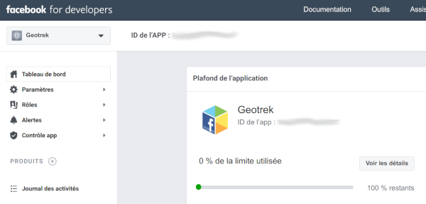
In custom.py set Facebook App ID:
FACEBOOK_APP_ID = '<your Facebook AppID>'
you can also override these settings:
FACEBOOK_IMAGE = '/images/logo-geotrek.png'
FACEBOOK_IMAGE_WIDTH = 200
FACEBOOK_IMAGE_HEIGHT = 200
Override translations
Translations are managed by https://weblate.makina-corpus.net/ where you can contribute.
But you can also override default translation files available in each module
(for example those from trekking module available in /opt/geotrek-admin/lib/python3.6/site-packages/geotrek/trekking/locale/fr/LC_MESSAGES/django.po).
Don’t edit these default files, use them to find which words you want to override.
Create the custom translations destination folder:
Create a django.po file in /opt/geotrek-admin/var/conf/extra_locale directory.
You can do one folder and one django.po file for each language
(example /opt/geotrek-admin/var/conf/extra_locale/fr/LC_MESSAGES/django.po for French translation overriding)
Override the translations that you want in these files.
Example of content for the French translation overriding:
# MY FRENCH CUSTOM TRANSLATION
# Copyright (C) YEAR THE PACKAGE'S COPYRIGHT HOLDER
# This file is distributed under the same license as the PACKAGE package.
# FIRST AUTHOR <EMAIL@ADDRESS>, YEAR.
#
msgid ""
msgstr ""
"Report-Msgid-Bugs-To: \n"
"POT-Creation-Date: 2018-11-15 15:32+0200\n"
"PO-Revision-Date: 2018-11-15 15:33+0100\n"
"Last-Translator: \n"
"Language-Team: LANGUAGE <LL@li.org>\n"
"MIME-Version: 1.0\n"
"Content-Type: text/plain; charset=UTF-8\n"
"Content-Transfer-Encoding: 8bit\n"
"Project-Id-Verésion: PACKAGE VERSION\n"
"Plural-Forms: nplurals=2; plural=(n > 1);\n"
"Project-Id-Version: \n"
"X-Generator: Poedit 1.5.4\n"

msgid "City"
msgstr "Région"

msgid "District"
msgstr "Pays"
Apply changes (French translation in this example):
cd /opt/geotrek-admin/var/conf/extra_locale
sudo chown geotrek. fr/LC_MESSAGES/
sudo geotrek compilemessages
sudo service geotrek restart
Override public PDF templates
PDF are generated from HTML templates, using Django templating. Treks, touristic contents, touristic events, outdoor sites and courses can be exported in PDF files.
Treks :
geotrek/trekking/templates/trekking/trek_public_pdf.htmlTouristic contents :
geotrek/tourism/templates/tourism/touristiccontent_public_pdf.htmlTouristic events :
geotrek/tourism/templates/tourism/touristiccontent_public_pdf.htmlOutdoor sites :
geotrek/outdoor/templates/outdoor/site_public_pdf.htmlOutdoor courses :
geotrek/outdoor/templates/outdoor/course_public_pdf.html
Overriden templates have to be located in /opt/geotrek-admin/var/conf/extra_templates/<appname>, with <appname> = trekking or tourism.
To override trekking PDF for example, copy the file geotrek/trekking/templates/trekking/trek_public_pdf.html
to /opt/geotrek-admin/var/conf/extra_templates/trekking/trek_public_pdf.html. Or add inside your file:
{% extends "trekking/trek_public_pdf.html" %}
These templates derive from base templates, which content is organized in blocks.
To override for example the description block of trek PDF, copy and change the {% block description }…{% endblock description %}
in your /opt/geotrek-admin/var/conf/extra_templates/trekking/trek_public_pdf.html.
It is also possible to use color defined for practice for pictogram by adding in your
/opt/geotrek-admin/var/conf/extra_templates/trekking/trek_public_pdf.html file:
{% block picto_attr %}style="background-color: {{ object.practice.color }};"{% endblock picto_attr %}
CSS can be overriden like html templates: copy them to var/media/templates/trekking/ or var/media/templates/tourism/ folder
/opt/geotrek-admin/var/conf/extra_templates/trekking/trek_public_pdf.css for example.
You can also create a template for each portal.
Add a folder portal_{id_portal} (portal ids are located in the portal url path /admin/common/targetportal/{id_portal}) in
/opt/geotrek-admin/var/conf/extra_templates/<appname>, as the first template, and add at the top of your file:
{% extends "trekking/trek_public_pdf.html" %}
The template for a specific portal will use the modification made on the overriden template in /opt/geotrek-admin/var/conf/extra_templates/<appname>
( except if you change specific block)
Note
This modification is not mandatory, if you have multiple portal and you want to modify the template of only one portal, you create one folder for this specific portal
You might need to use your own images in the PDF templates.
Add your own images in /opt/geotrek-admin/var/conf/extra_static/images/.
You can then use these images in your PDF templates with {% static 'images/file.jpg' %}, after adding {% load static %} at the top of the file.
Example of a customised template (/opt/geotrek-admin/var/conf/extra_templates/trekking/trek_public_pdf.html) with a customised logo and URL:
{% extends "trekking/trek_public_pdf.html" %}
{% load static %}

{% block logo %}
   <img src="{% static 'images/logo-gte.jpg' %}" alt="Grand tour des Ecrins">
{% endblock %}
{% block url %}
   <div class="main">Grand tour des Ecrins</div>
   <div class="geo"><a href="https://www.grand-tour-ecrins.fr">grand-tour-ecrins.fr</a></div>
{% endblock url %}
Note
The default template may change in the future versions. You will be in charge of porting the modification to your copy.
Test your modifications by exporting a trek or a content to PDF from Geotrek-admin application.
To get your modifications available for Rando application, launch the sync_rando command.
PDF as booklet
USE_BOOKLET_PDF = True
Use booklet for PDF. During the synchro, pois details will be removed, and the pages will be merged. It is possible to customize the pdf, with trek_public_booklet_pdf.html.
Custom font in public document template
In order to use custom fonts in trek PDF, it is necessary to install the font files on the server.
Microsoft fonts like Arial and Verdana can be installed via the package manager:
sudo apt-get install ttf-mscorefonts-installer
For specific fonts, copy the .ttf (or .otf) files into the folder
/usr/local/share/fonts/custom/ as root, and run the following command:
fc-cache
For more information, check out Ubuntu documentation.
Custom colors in public document template
Trek export geometries are translucid red by default. In order to control the apparence of objects in public trek PDF exports, use the following setting:
MAPENTITY_CONFIG['MAP_STYLES']['print']['path'] = {'weight': 3}
See Leaflet reference documentation for detail about layers apparence.
Primary color in PDF templates
You can override PRIMARY_COLOR to change emphase text in PDF export.
Beware of contrast, white colour is used for text so we advise you to avoid light colour.
PRIMARY_COLOR = "#7b8c12"
Custom logos
You might also need to deploy logo images in the following places :
var/conf/extra_static/images/favicon.pngvar/conf/extra_static/images/logo-login.pngvar/conf/extra_static/images/logo-header.png
Settings for Geotrek-rando
Synchro Geotrek-rando
With Geotrek-rando V2, there is a synchronization mechanism to expose Geotrek-admin contents in json files generated automatically. This is no more used in Geotrek-rando V3.
SYNC_RANDO_ROOT = os.path.join(VAR_DIR, 'data')
Path on your server where the data for Geotrek-rando website will be generated
If you want to modify it, do not forget to import os at the top of the file. Check import Python , if you need any information
SYNC_RANDO_OPTIONS = {}
Options of the sync_rando command in Geotrek-admin interface.
Distances
TOURISM_INTERSECTION_MARGIN = 500
Distance to which tourist contents, tourist events, treks, pois, services will be displayed
This distance can be changed by practice for treks in the admin.
DIVING_INTERSECTION_MARGIN = 500
Distance to which dives will be displayed.
Limits
TREK_EXPORT_POI_LIST_LIMIT = 14
Limit of the number of pois on treks pdf.
14 is already a huge amount of POI, but it’s possible to add more
TREK_EXPORT_INFORMATION_DESK_LIST_LIMIT = 2
Limit of the number of information desks on treks pdf.
You can put -1 if you want all the information desks
Cateogories
SPLIT_TREKS_CATEGORIES_BY_PRACTICE = False
On the Geotrek-rando v2 website, treks practices will be displayed separately
Field order for each practices in admin will be take in account
SPLIT_TREKS_CATEGORIES_BY_ACCESSIBILITY = False
On the Geotrek-rando v2 website, accessibilites will be displayed separately
SPLIT_TREKS_CATEGORIES_BY_ITINERANCY = False
On the Geotrek-rando v2 website, if a trek has a children it will be displayed separately
SPLIT_DIVES_CATEGORIES_BY_PRACTICE = True
On the Geotrek-rando v2 website, dives practices will be displayed separately
HIDE_PUBLISHED_TREKS_IN_TOPOLOGIES = False
On the Geotrek-rando v2 website, treks near other are hidden
TREK_WITH_POIS_PICTURES = False
It enables correlated pictures on Gotrek-rando v2 to be displayed in the slideshow
ONLY_EXTERNAL_PUBLIC_PDF = False
On Geotrek-rando v2 website, only PDF imported with filetype “Topoguide” will be used and not autogenerated.
TREK_CATEGORY_ORDER = 1
ITINERANCY_CATEGORY_ORDER = 2
DIVE_CATEGORY_ORDER = 10
TOURISTIC_EVENT_CATEGORY_ORDER = 99
Order of all the objects without practices on Geotrek-rando website
All the settings about order are the order inside Geotrek-rando website.
Practices of diving, treks and categories of touristic contents are taken in account
Settings for Geotrek-mobile
SYNC_MOBILE_ROOT = os.path.join(VAR_DIR, 'mobile')
Path on your server where the datas for mobile will be saved
If you want to modify it, do not forget to import os at the top of the file. Check import Python , if you need any information
SYNC_MOBILE_OPTIONS = {'skip_tiles': False}
Options of the sync_mobile command
MOBILE_NUMBER_PICTURES_SYNC = 3
Number max of pictures that will be displayed and synchronized for each object (trek, poi, etc.) in the mobile app.
MOBILE_TILES_URL = ['https://{s}.tile.opentopomap.org/{z}/{x}/{y}.png']
URL’s Tiles used for the mobile.
Change for IGN:
MOBILE_TILES_URL = ['https://{s}.tile.opentopomap.org/{z}/{x}/{y}.png']
MOBILE_LENGTH_INTERVALS =  [
    {"id": 1, "name": "< 10 km", "interval": [0, 9999]},
    {"id": 2, "name": "10 - 30", "interval": [9999, 29999]},
    {"id": 3, "name": "30 - 50", "interval": [30000, 50000]},
    {"id": 4, "name": "> 50 km", "interval": [50000, 999999]}
]
Intervals of the mobile for the length filter
Interval key is in meters. You can add new intervals
MOBILE_LENGTH_INTERVALS =  [
    {"id": 1, "name": "< 10 km", "interval": [0, 9999]},
    {"id": 2, "name": "10 - 30 km", "interval": [9999, 29999]},
    {"id": 3, "name": "30 - 50 km", "interval": [30000, 50000]},
    {"id": 4, "name": "50 - 80 km", "interval": [50000, 80000]}
    {"id": 5, "name": "> 80 km", "interval": [80000, 999999]}
]
MOBILE_ASCENT_INTERVALS = [
    {"id": 1, "name": "< 300 m", "interval": [0, 299]},
    {"id": 2, "name": "300 - 600", "interval": [300, 599]},
    {"id": 3, "name": "600 - 1000", "interval": [600, 999]},
    {"id": 4, "name": "> 1000 m", "interval": [1000, 9999]}
]
Intervals of the mobile for the ascent filter
Do the same as above
MOBILE_DURATION_INTERVALS = [
    {"id": 1, "name": "< 1 heure", "interval": [0, 1]},
    {"id": 2, "name": "1h - 2h30", "interval": [1, 2.5]},
    {"id": 3, "name": "2h30 - 5h", "interval": [2.5, 5]},
    {"id": 4, "name": "5h - 9h", "interval": [5, 9]},
    {"id": 5, "name": "> 9h", "interval": [9, 9999999]}
]
Intervals of the mobile for the duration filter
Check MOBILE_LENGTH_INTERVALS comment to use it, here interval correspond to 1 unit of hour
ENABLED_MOBILE_FILTERS = [
    'practice',
    'difficulty',
    'durations',
    'ascent',
    'lengths',
    'themes',
    'route',
    'districts',
    'cities',
    'accessibilities',
]
List of all the filters enabled on mobile.
Remove any of the filters if you don’t want one of them. It’s useless to add other one.
Settings details
Search settings in this page to have information.